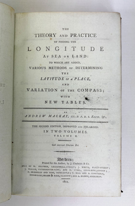
The Theory and Practice of Finding the Longitude at Sea or Land, Vol.II, Andrew Mackay, 1801
This is Volume II of Andrew Mackay’s The Theory and Practice of Finding the Longitude at Sea or Land (1801, second edition, improved and enlarged), an important early 19th‑century manual on practical navigation and astronomical calculation. Mackay, a Scottish mathematician and Fellow of the Royal Society of Edinburgh, produced one of the most thorough guides of its time for mariners, surveyors, and navigators, covering the determination of longitude and latitude, compass variation, and the application of newly refined tables.
The determination of longitude at sea was one of the great scientific challenges of the 17th and 18th centuries. Unlike latitude, which could be established using the sun’s elevation, longitude required accurate timekeeping or precise astronomical measurements to determine a ship’s position east or west. Before the widespread use of marine chronometers and the adoption of the lunar distance method, navigators often faced grave uncertainty, which led to shipwrecks and navigational errors. Mackay’s work offered systematic explanations, mathematical tables, and fold‑out diagrams to help mariners apply these emerging techniques in practice, representing the cutting edge of navigational science at the dawn of the 19th century.
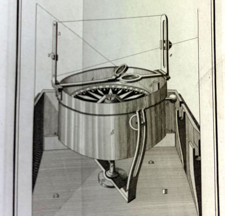
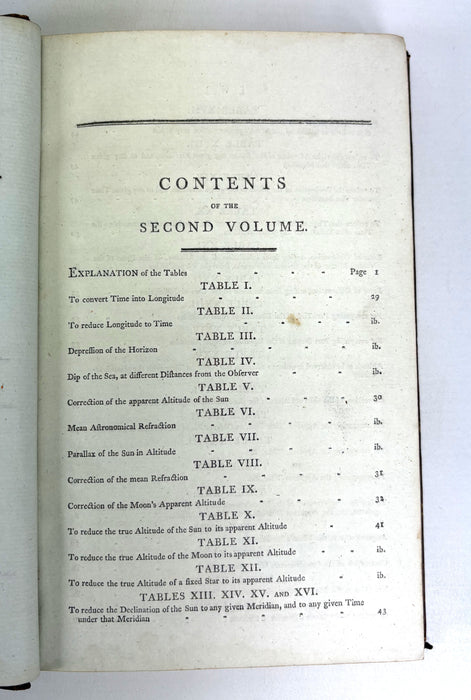
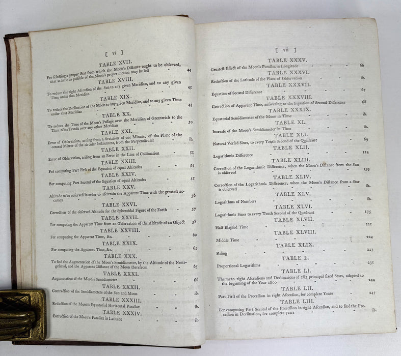
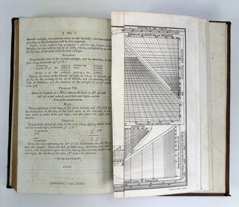
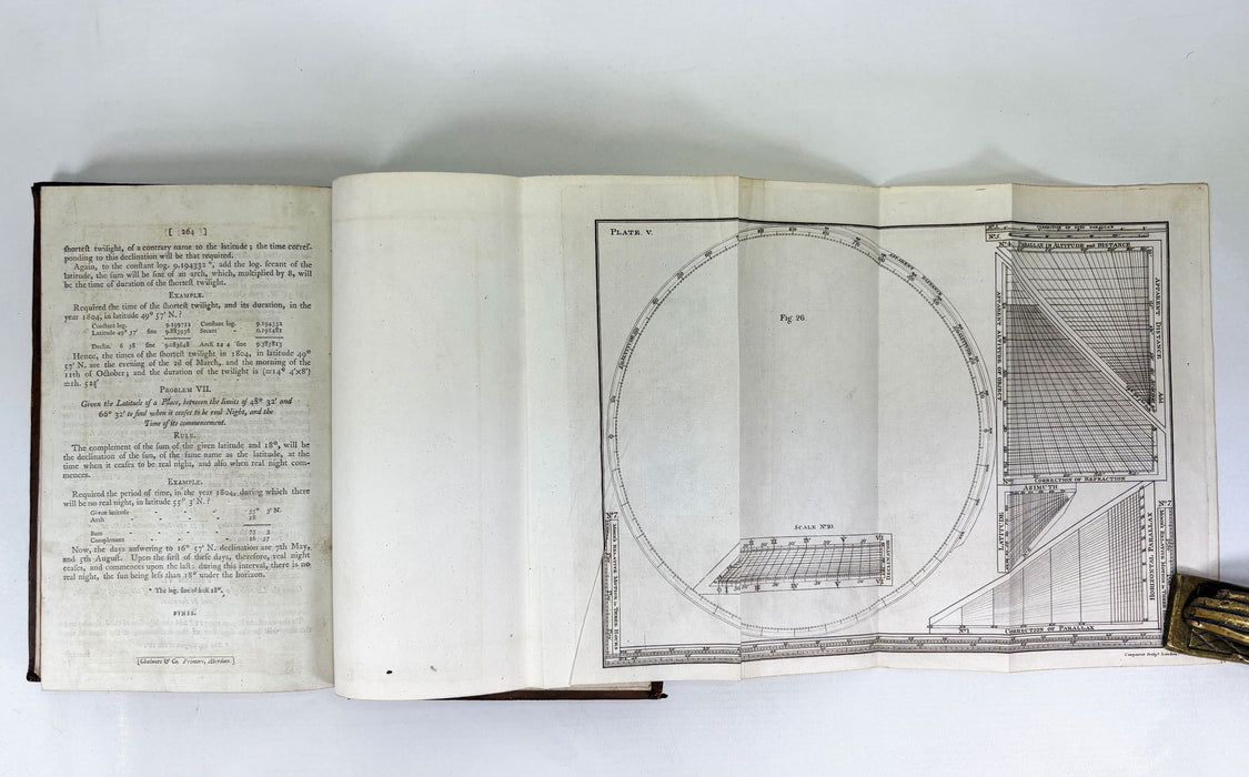
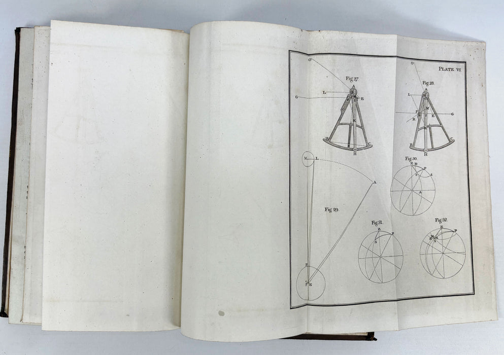
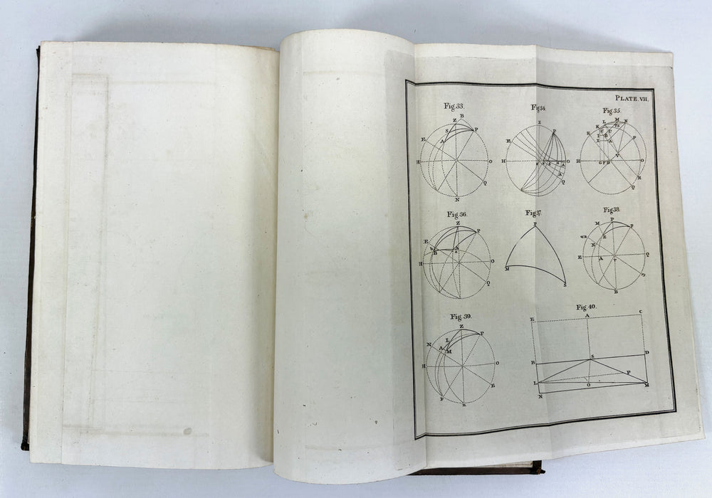
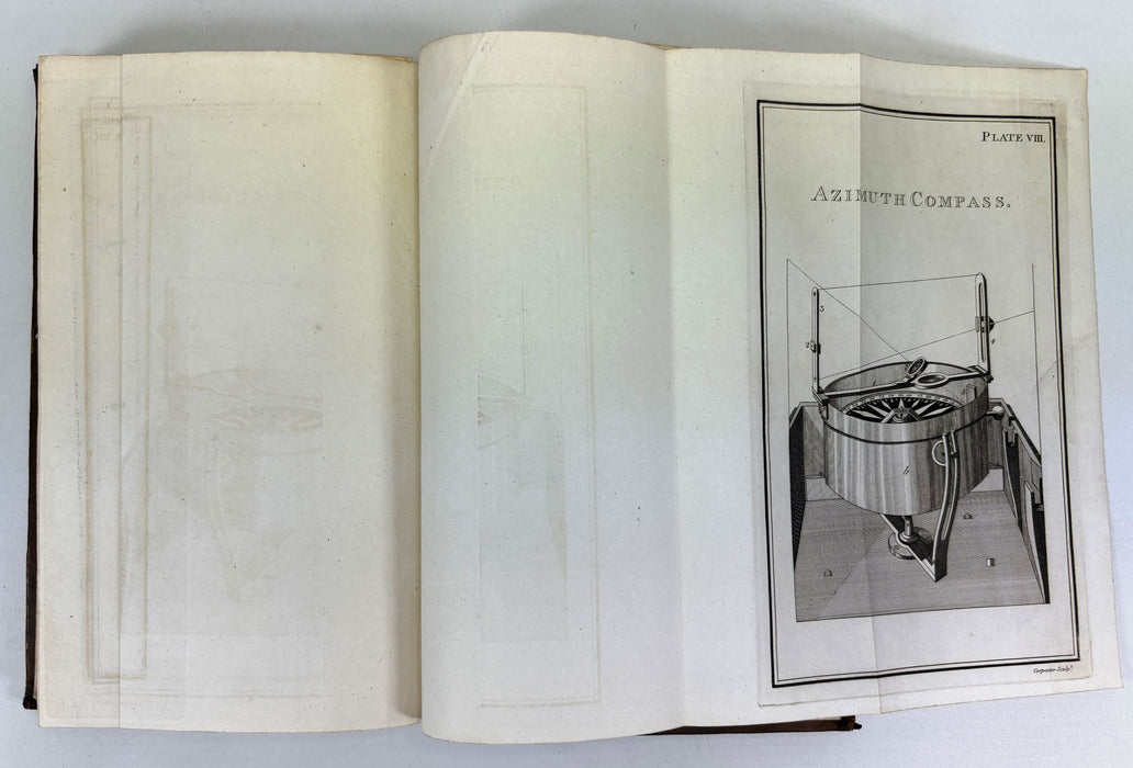
This volume contains the working tables, explanations, and 4 fold‑out plates, illustrating the practical application of the methods described in the text. Its focus on computation and the use of astronomical observations reflects the period’s critical efforts to improve maritime safety and global navigation.
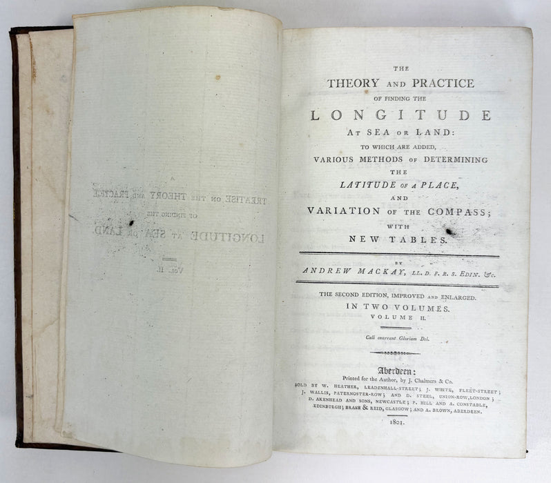
The Theory and Practice of Finding the Longitude at Sea or Land: To Which are Added, Various Methods of Determining the Latitude of a Place, and Variation of the Compass; With New Tables. The Second Edition, Improved and Enlarged. In Two Volumes. Volume II. By Andrew Mackay (Note: This is Vol. II only).
Printed for the Author, by J. Chalmers & Co, Aberdeen. Sold by W. Heather, J. White, J. Wallis; and D. Steel, London; D. Akenhead and Sons, Newcastle; F. Hill and A. Constable, Edinburgh; Brash & Reid, Glasgow; and A. Brown, Aberdeen. 1801 Second edition.
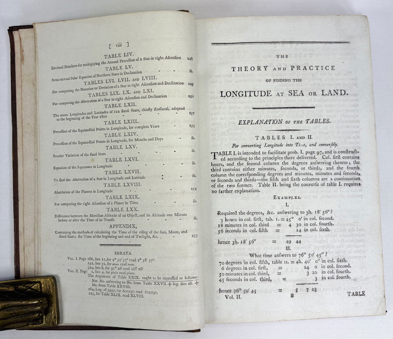
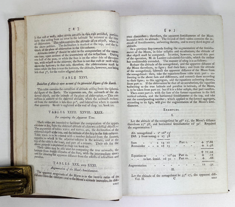
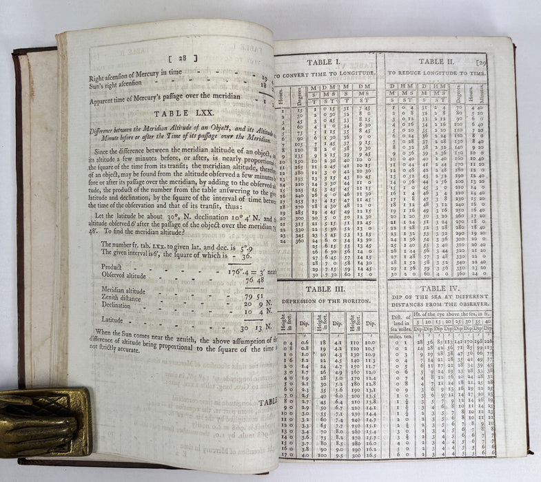
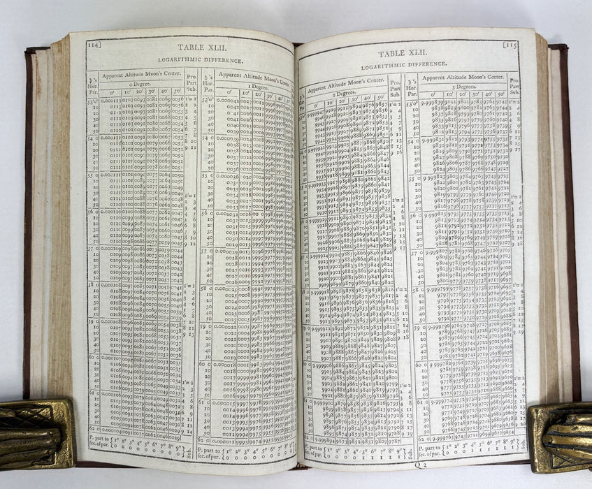
This volume provides detailed explanations of how to use the comprehensive tables and carry out the necessary calculations. At the rear are 4 fold-out Plates.
A very good hardback in full contemporary calf with gilt lined spine, and red morocco title label with gilt. Leather with some light and bumping. Some rubbing to joints, but all soundly bound. Some losses to the label.
Text is clean and bright throughout and fold-outs are clean and intact.
Text in English.
viii + 28pp text + 29-257pp Tables + 258-264pp text + 4 fold-out Plates (V-VIII; all Plates as called for in this volume).
Weight approximately 456g (unpacked).
Approx Dimensions: 225mm high x 242mm wide x 27mm deep.